
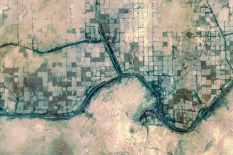


Geospatial technology took centre stage on GIS Day, Wednesday, 18 November 2026, and canal irrigation is one of its clearest uses in India. Geographic Information Systems, or GIS, collect, analyse and map location data, letting water managers see whole canal networks at once. India has poured resources into major and medium irrigation schemes, yet many canal projects fall short, with seepage, waterlogging and uneven delivery as recurring problems. Geospatial technology offers a practical way to find where water is lost and where it is needed most.
Canal irrigation has long underpinned food security across South Asia. Traditional field methods struggle to track systems that stretch over thousands of kilometres, because they capture only scattered shots of dynamic systems. Satellite imagery, drone surveys and GIS databases now give managers continuous views of irrigation. Geospatial technology has shifted the question from whether these tools can help to how best to deploy them at scale, and several Indian projects show what that looks like in practice.
Geospatial technology maps Gujarat canals
Gujarat has mapped its irrigation network in detail. The state has about 26,295 km of canals, more than 6,000 km of pipelines and 490 km of recharge canals. The water resources department has built a digital twin of that infrastructure, with a geo database covering nearly 24,000 km of canal and 5,500 km of pipelines. More than 400 field officers have been trained on open-source GIS, satellite imagery and the Bhuvan geoportal. Geospatial technology now supports permission for canal crossings, monitoring of reservoir storage, tracking vegetation in command areas and planning drone surveys.
The geospatial layers are shared in interoperable formats, and a Web Map Service gives users standard access to interactive map data. The system has improved spatial data and sped up decision-making. It has become a digital backbone for the state’s Irrigation Master Plan, letting managers adapt water distribution across administrative levels. Geospatial technology shows what a state can do when canal maps, satellite data and field records sit in one system that engineers and planners can both use.
A study of the Kadi branch of the Narmada Main Canal in Gujarat shows how the same tools can target seepage. Researchers used Landsat data from 1990 to 2024, drone ortho-mosaics and ground measurements to generate vegetation and surface-moisture indices. The analysis found recurring moisture and vegetative anomalies next to the canal, confirming progressive seepage. An optimisation model then identified interventions that cut seepage and waterlogging while sustaining deliveries. Selective lining of high-loss segments with targeted sub-surface drainage could cut seepage by about 20 percent without hurting supply reliability.
Satellite soil moisture and irrigation timing
Geospatial technology is also changing how farmers decide when to irrigate. Operation Dronagiri, a Department of Science and Technology initiative, uses Synthetic Aperture Radar satellite imagery, machine learning and ground-truth validation to predict soil moisture. The project is run through the Technology Innovation Hub at IIT Tirupati Navavishkar I-Hub Foundation, and its Geo-Intel Lab builds applications for public good. By combining satellite data with field measurements, the models help farmers decide when to irrigate based on soil conditions, weather and crop needs.
The work sits inside the National Geospatial Policy, and the lab hosts India’s first Federated Geospatial Data Interface node. The expected gains are water conservation and higher yields at critical growth stages. Geospatial technology turns satellite data into a decision support tool that a farmer or a water manager can act on, rather than a map that sits in a report. Operation Dronagiri also covers transport and livelihoods, but the irrigation work is the clearest example of geospatial data reaching the field.
In April 2025, the Union Cabinet approved the Modernization of Command Area Development and Water Management, a new sub-scheme of the Pradhan Mantri Krishi Sinchayee Yojana, with an initial outlay of Rs 1,600 crore. The scheme pushes irrigation underground into pressurised pipes, and GIS-based design generates pipeline routes from elevation and land-record data. A GIS-based model tested in part of the Indo-Gangetic plain in Uttar Pradesh showed that canal water use efficiency can rise up to 58 percent. Geospatial technology runs through the design, construction and operation of these networks.
Geospatial technology and the road ahead
A global registry published in March 2026, called GRAIN, mapped over 3.8 million km of canals in 95 countries. The dataset fills a gap in global archives, where canal networks had remained poorly documented despite supporting roughly 40 percent of world farm output. For India, the next step is to close the remaining data gaps and train more field staff. The Gujarat digital twin, the Narmada seepage study and the Dronagiri soil moisture models all point the same way: maps and satellite data can put more of India’s canal water where it is needed.