
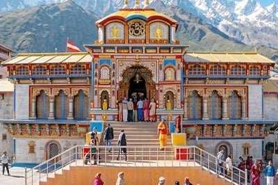


Badrinath, 1 November: A modelling study of hanging glaciers above the pilgrimage town of Badrinath has warned of serious exposure if ice from one of those glaciers were to collapse, with the Badrinath glacier risk assessed in the Badrinath glacier risk study for three sites above the town. The study, published in the journal Landslides on 28 October 2026, was carried out by researchers from the Indian Institute of Science, the University of Cambridge and the Defence Research and Development Organisation, which funded the work. It used satellite data and computer models to simulate how ice avalanches from those glaciers could travel down the valley and what they could reach.
Badrinath sits at about 3,415 metres on the Alaknanda River in Uttarakhand, below steep slopes that hold hanging glaciers. Those are masses of ice that cling to steep mountainsides and end abruptly, which makes them liable to sudden break-offs. The researchers screened glaciers with a mean surface slope of at least 30 degrees and selected three near the town, at altitudes between 4,700 and 5,465 metres, for detailed assessment. The town draws large numbers of pilgrims each year, and about 1.7 million pilgrims visited during the 2025 Char Dham yatra, according to summaries of the study.
Badrinath glacier risk at three sites
The Badrinath glacier risk study assessed each of the three sites under low, medium and high mobility conditions, varying friction values in the Rapid Mass Movement Simulation model to reflect different flow behaviour. Release areas and ice volumes were calculated from remote-sensing data, and avalanche dynamics were simulated for each site. The results showed that flow behaviour was driven mainly by release volume, glacier slope and downstream terrain, with larger volumes and steeper slopes producing greater flow intensity and longer runout.
Site 2 posed the greatest Badrinath glacier risk threat to the town, according to the study. It had a large potential release volume, a surface slope of 34.57 degrees and a bed slope of 30.64 degrees, and those factors combined to give it the highest downstream exposure of the three sites. Summaries of the study put the ice volume at the site at about 5.3 million cubic metres and the simulated peak velocity of a potential avalanche at 78.5 metres per second, with a flow height of up to 73.5 metres. The researchers cautioned against treating the other two sites as minor threats, even though site 2 produced the most severe results.
The study also placed the three sites in a wider context. An earlier basin-scale inventory identified 219 hanging glaciers in the Alaknanda basin, covering about 72 square kilometres with an estimated ice volume of about 2.39 cubic kilometres. About one third of those glaciers were classed as unstable.
Badrinath glacier risk in the worst case
Under the high mobility Badrinath glacier risk scenario for site 2, the assessment put about 398 buildings within the exposure zone, along with 2.66 kilometres of transport infrastructure, 3.87 hectares of agricultural land and 15.57 hectares of forest cover. Critical facilities in the zone included a helipad and parking areas, and summaries of the study also listed two bridges among the structures at risk. Those Badrinath glacier risk figures are scenario estimates for a worst case, and they are not a prediction that a collapse is imminent or that it will happen on any particular date.
Badrinath glacier risk exposure is also growing. The earlier inventory work projected that the population at risk in vulnerable areas of the basin could rise from about 380 to more than 8,500 by 2030, as built-up area in those zones grows from about 8,000 square metres in 2000 to more than 150,000 square metres. Roads, hydropower projects, tourism and urban growth have pushed more buildings and people closer to glacier slopes, especially along the Badrinath-Mana stretch, where infrastructure has expanded steadily.
Badrinath glacier risk and what monitoring means
The findings follow the 2021 Chamoli disaster, in which a rock and ice avalanche killed more than 200 people and underlined the danger of glacier-related collapses in Uttarakhand. That disaster is cited in reporting on the new study as a reminder that hanging glacier failures can have severe consequences downstream, including river blockage, temporary lakes and flash floods. The new study does not link its three Badrinath sites to a specific imminent event, but it adds a detailed, site-by-site picture to the broader inventory of unstable ice in the Alaknanda basin. Monitoring and early warning, along with limits on building in runout zones, are the practical responses discussed in reporting on the study, using repeated satellite surveys to track crevasses, ice movement and meltwater.